Old Ordnance Survey Maps of Burley in Wharfedale, Burley Woodhead and Stead.
OS Maps from the years: 1851, 1895, 1909, 1934 & 1983.
The images are reproduced with the permission of the National Library of Scotland's Digital Map Service.
Burley in Wharfedale OS Map - Surveyed 1847 to 1848. Published 1851. Believe this is a later iteration as the Otley & Ilkley Joint Railway wasn't built until 1865.
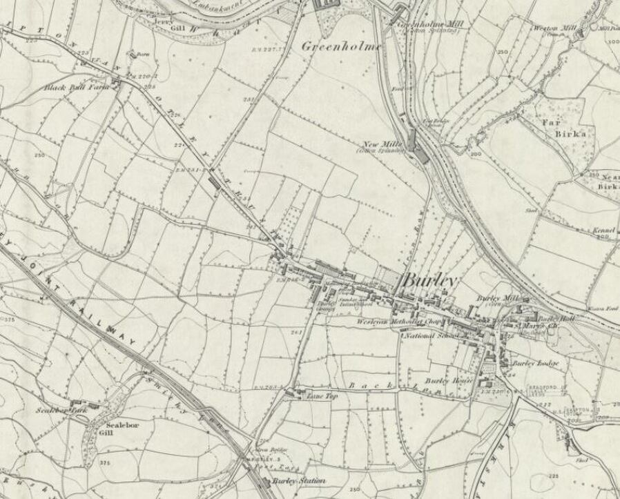
Burley in Wharfedale. Reproduced with the permission of the National Library of Scotland
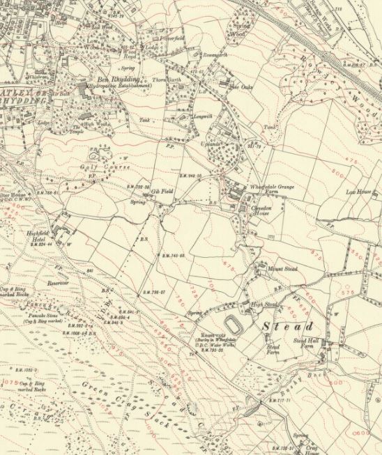
Burley Woodhead and Stead OS Map - Surveyed 1847 to 1848. Published 1851. Believe this is a later iteration as the Otley & Ilkley Joint Railway wasn't built until 1865.
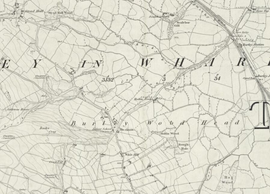
Burley Woodhead & Stead 1851. Reproduced with the permission of the National Library of Scotland
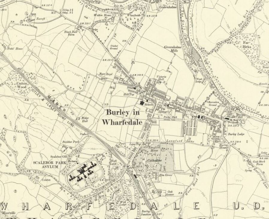
Burley in Wharfedale OS Map Surveyed 1889 to 1891. Published 1895.
Burley in Wharfedale OS Map 1895. Reproduced with the permission of the National Library of Scotland
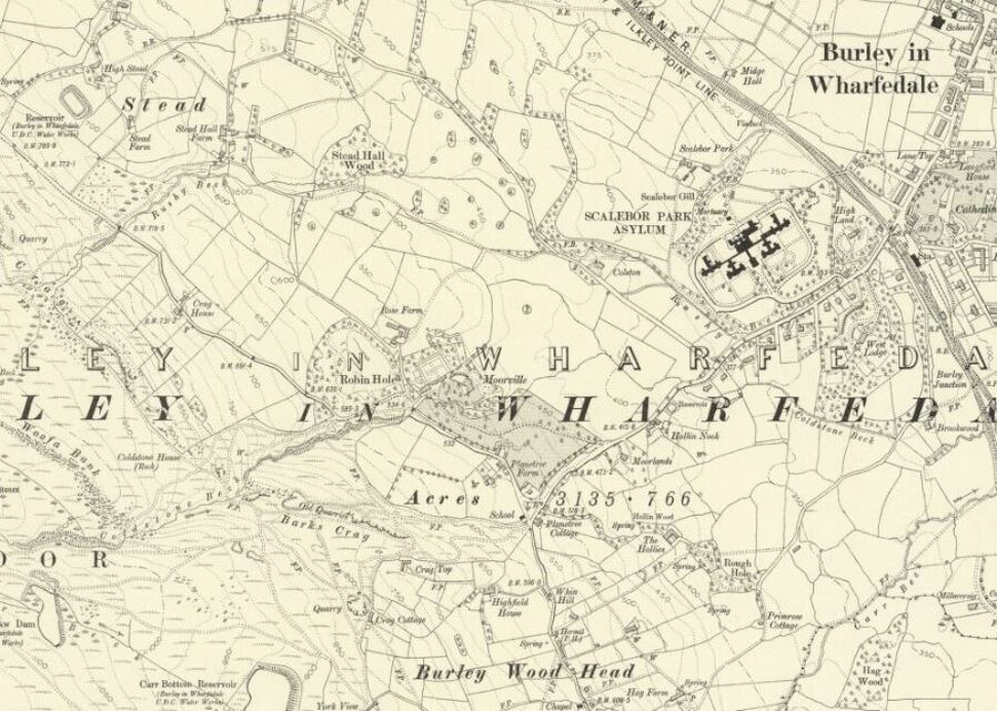
Burley Woodhead and Stead OS Map Surveyed 1889 to 1891. Published 1895.
Burley Woodhead & Stead 1895. Reproduced with the permission of the National Library of Scotland
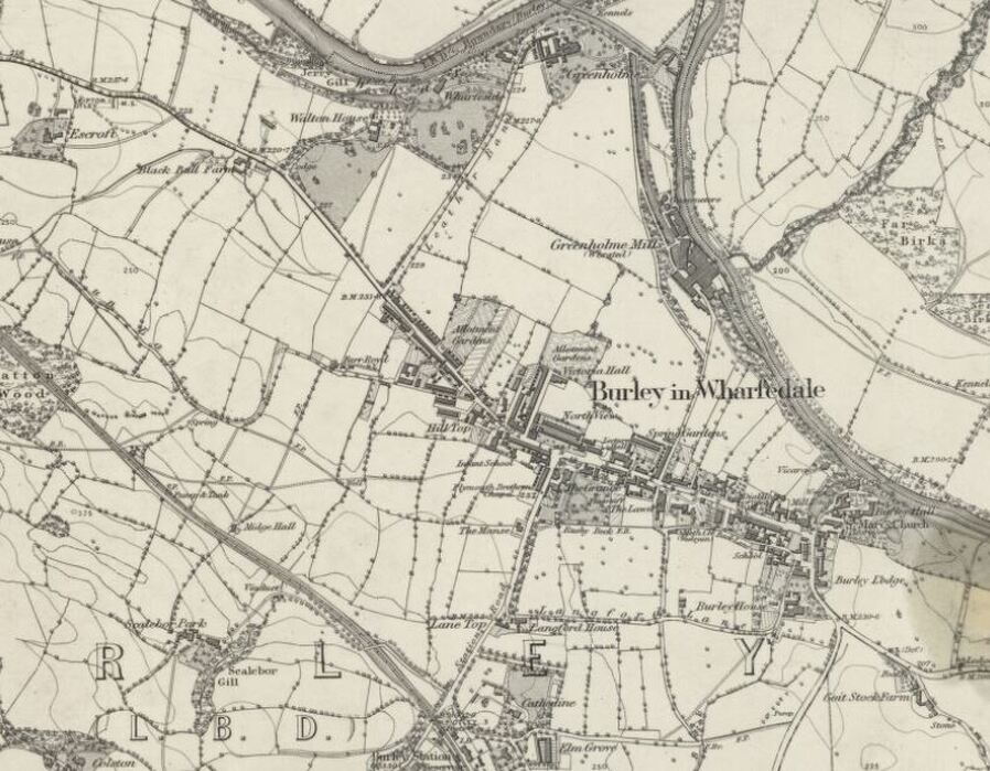
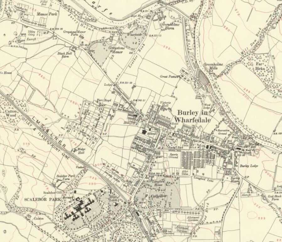
Burley in Wharfedale OS Map - Revised 1906 to 1907. Published 1909.
Burley in Wharfedale 1909. Reproduced with the permission of the National Library of Scotland
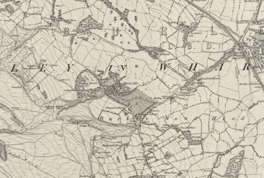
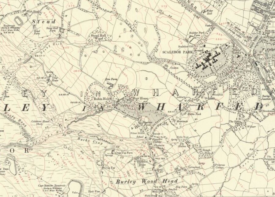
Burley Woodhead and Stead OS Map - Revised 1906 to 1907. Published 1909.
Burley Woodhead and Stead 1909. Reproduced with the permission of the National Library of Scotland
Burley in Wharfedale OS Map - Revised 1934. Published 1934.
Burley in Wharfedale 1934. Reproduced with the permission of the National Library of Scotland
Burley Woodhead and Stead OS Map - Revised 1934. Published 1934
Burley Woodhead and Stead 1934. Reproduced with the permission of the National Library of Scotland
Stead OS Map 1934 showing the Urban District Boundary (U. D. By.). Its the dotted line that tracks from bottom left to top right on the image. Reproduced with the permission of the National Library of Scotland
Stead 1934 showing the Urban District Boundary. Reproduced with the permission of the National Library of Scotland
1983 Map of Burley in Wharfedale & part of Burley Woodhead
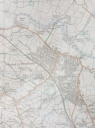
1983 Map of Burley in Wharfedale. Image courtesy of Jack Smith-Eccles
Google Map of Burley District Boundary
This multi-layered map complements the OS Maps from 1851, 1895, 1909 and 1934.
|
Click on the square with the arrow (top left) for a "Listings Key". Tick or untick the layers you want to see. Zoom in on the map. Click on the dashed square (top right) for a full screen version. |
Listings Key shows 5 layers:
1. Burley District Boundary as of 2006. 2. Burley District Boundary changes between Stead & Ben Rhydding since OS 1934 Map. 3. Burley History Trail - Red Pins - including The Grange, Burley in Wharfedale Railway Station etc. 4. Notable Sites within Burley District - Green Pins - such as Burley Library, Scalebor Park pavilion, Greenholme (Burley Hydro), 5. Housing Estates & Sites since the 1920s, |
For the Housing Layer click on an estate/housing site for information about it. (CH means Council Housing).
This map is work in progress, if you have dates for those housing sites with question marks attached please contact the webmaster with the details.
For the boundary changes tick Burley District Boundary & Boundary Changes layers.
This map is work in progress, if you have dates for those housing sites with question marks attached please contact the webmaster with the details.
For the boundary changes tick Burley District Boundary & Boundary Changes layers.
(Note: Burley District Boundary is the administrative boundary for Burley Parish Council, not St Mary's Parish Church boundary).
Burley Community Library & Burley Archive, Grange Road, Burley in Wharfedale, West Yorkshire England LS29 7HD
Opening Times: Monday, Tuesday and Friday 10.00am to 5.00pm, Thursday 2.00pm to 7.00pm, Saturday 10.00am to 1.00pm. Closed Wednesday & Sunday
Burley Local History & Archive Group: Drop-In Sessions Friday 2.30pm to 4.30pm. For other times please contact us
Burley Local History & Archive Group: Drop-In Sessions Friday 2.30pm to 4.30pm. For other times please contact us
